Muscat: The National Multi-Hazard Early Warning Center has issued a weather alert, indicating that the Sultanate of Oman may be impacted by a depression originating from the Arabian Sea. This weather system is projected to affect the region from the evening of Monday, August 5, 2024, through Wednesday, August 7, 2024.
According to Report No. 1 from the Civil Aviation Authority (CAA), this depression is anticipated to lead to an increase in cloud cover and scattered rainfall across the majority of Oman's governorates. Rainfall is expected, with a particular focus on the governorates of South Al Batinah, Al Dakhiliyah, Muscat, North Al Batinah, Al Dhahirah, Al Buraimi, North Al Sharqiyah, South Al Sharqiyah, and Musandam.
Forecast Details by Day:
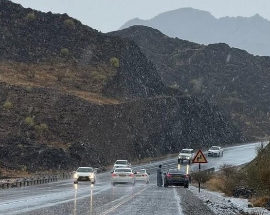
Monday and Tuesday Evening (August 5-6): It is expected that there will be widespread cloud formation across most governorates. Cumulus clouds are likely to develop in the Hajar Mountains and the surrounding areas around noon and evening. Rainfall is anticipated to vary in intensity, with the possibility of thundery conditions in several governorates, including South Al Batinah, North Al Sharqiyah, South Al Sharqiyah, North Al Batinah, Muscat, Al Dakhiliyah, and parts of Al Dhahirah, Al Buraimi, Al Wusta, and Musandam.
Heavy rainfall, ranging from 25 to 50 mm, is projected to be concentrated in the governorates of South Al Batinah, Al Dakhiliyah, Muscat, and North Al Batinah. This could lead to flooding in certain areas, including reefs and valleys. Wind speeds are expected to be strong, ranging from 15 to 35 knots (28 to 65 km/h), which may result in the displacement of materials and a reduction in visibility during thunderstorms and dust storms. Coastal areas along the Sea of Oman and the Arabian Sea could experience rough waves up to four meters in height.
Wednesday, August 7: Cloud formation and scattered rain are expected to persist, with the possibility of thundery conditions along the coasts of South Al Batinah, North Al Batinah, Muscat, and South Al Sharqiyah. Cumulus clouds are anticipated to form over the Hajar Mountains and the surrounding areas during the noon and evening hours. Rainfall amounts are projected to range from 20 to 40 mm, with similar flooding risks for reefs and valleys. Wind speeds are expected to remain between 15 and 35 knots (28 to 65 km/h), with reduced visibility and potential dust storms. Coastal waters may continue to experience rough waves up to four meters in height.
Residents are encouraged to stay informed about weather updates and to exercise caution during this period of unsettled weather conditions.