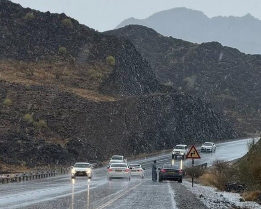
Muscat: It is anticipated that isolated rainfall, characteristic of thunderstorms, will be observed across certain regions of the Sultanate of Oman for a duration of four days, starting from Tuesday, July 30, 2024, and concluding on Friday, August 2, 2024.
The most recent updates and analysis provided by the National Multi Hazard Early Warning Center suggest that the Sultanate of Oman will be subjected to the influence of a low-pressure system in the Arabian Sea, commencing from this evening, July 30, 2024, and extending until Friday, August 2, 2024. It is expected that clouds will be advected over the majority of the Sultanate of Oman's governorates, with the possibility of isolated rain, occasionally accompanied by thunderstorms, in the South Al Sharqiyah and Al Wusta Governorates, as well as in the North Al Sharqiyah, Muscat, and Dhofar Governorates.
Details of the Daily Weather Conditions:
Tuesday and Wednesday Evening:
There will be an advection of clouds over the majority of the Sultanate of Oman's governorates, and the likelihood of cloud formation, particularly during the afternoon and evening hours, is expected over the Al Hajar Mountains and the areas adjacent to them. Additionally, there is a chance of cloud advection and formation associated with isolated rain, occasionally followed by thunderstorms, starting this evening in the South Al Sharqiyah Governorate, which may spread to include the coastal areas of the Al Wusta Governorate and parts of the North Al Sharqiyah and Muscat Governorates. There will also be ongoing opportunities for drizzle and isolated rain over the coastal and mountainous regions of the Dhofar Governorate.
Expected Impact:
- Rainfall ranging from 10 to 30 millimeters could result in the flow of some waterways.
- Fresh downdraft winds, with speeds varying between 15 to 35 knots (27 to 60 km/h), are anticipated, which may lead to the displacement of unstable objects.
- A decrease in horizontal visibility is expected during thunderstorms, and there may be an increase in dust due to the downdraft winds.
- The sea along the Arabian Sea coasts is projected to become rough, with a maximum height of four meters.
Thursday and Friday:
Cloud advection and formation, coupled with the possibility of isolated rain, occasionally followed by thunderstorms, are expected in the coastal areas of South Al Sharqiyah and Al Wusta Governorates. There will also be a likelihood of cloud formation during the afternoon and evening hours over the Al Hajar Mountains and the areas adjacent to them. The opportunities for drizzle and isolated rain over the coastal and mountainous regions of the Dhofar Governorate are expected to persist.
Expected Impacts:
- Rainfall between 10 to 25 millimeters could result in the discharge of certain waterways.
- The introduction of fresh downdraft winds, characterized by speeds between 15 to 35 knots (27 to 60 kilometers per hour), may cause the displacement of unstable objects.
- A reduction in horizontal visibility is anticipated during thunderstorms, accompanied by the ascent of dust particles due to the downdraft winds.
- The Arabian Sea coasts are expected to experience rough seas, with a maximum height of four meters.